Loading
04 / MARKSAFE.NET · PASSION PROJECT · 2025 · BUILT SOLO
Pakistan loses hundreds of lives
yearly to preventable
street hazards.
نشان لگائیں۔ رپورٹ کریں۔ محفوظ بنائیں۔
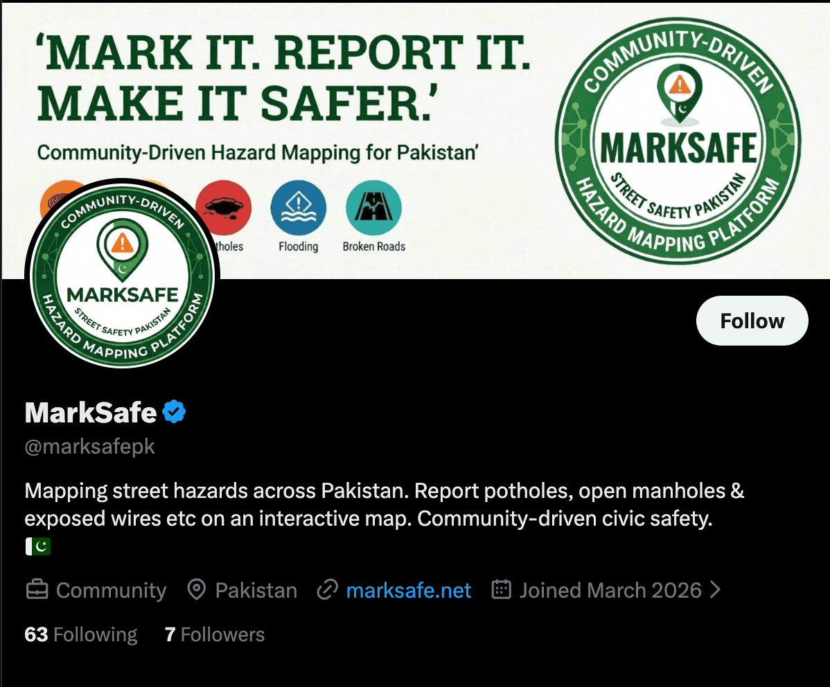
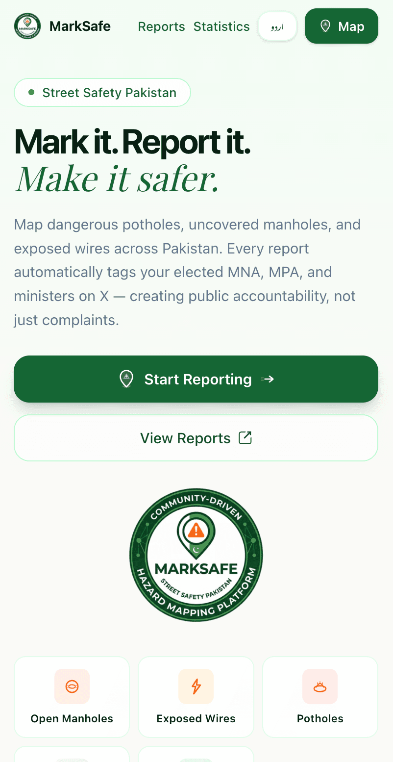
Mark it. Report it. Make it safer.
Mission
"Map dangerous potholes, uncovered manholes, and exposed wires across Pakistan… creating public accountability, not just complaints."
A community-driven hazard mapping platform built to make Pakistan's streets safer. Every report is a data point. Every upvote is a signal. Every X post is a paper trail.
·marksafe.net · live
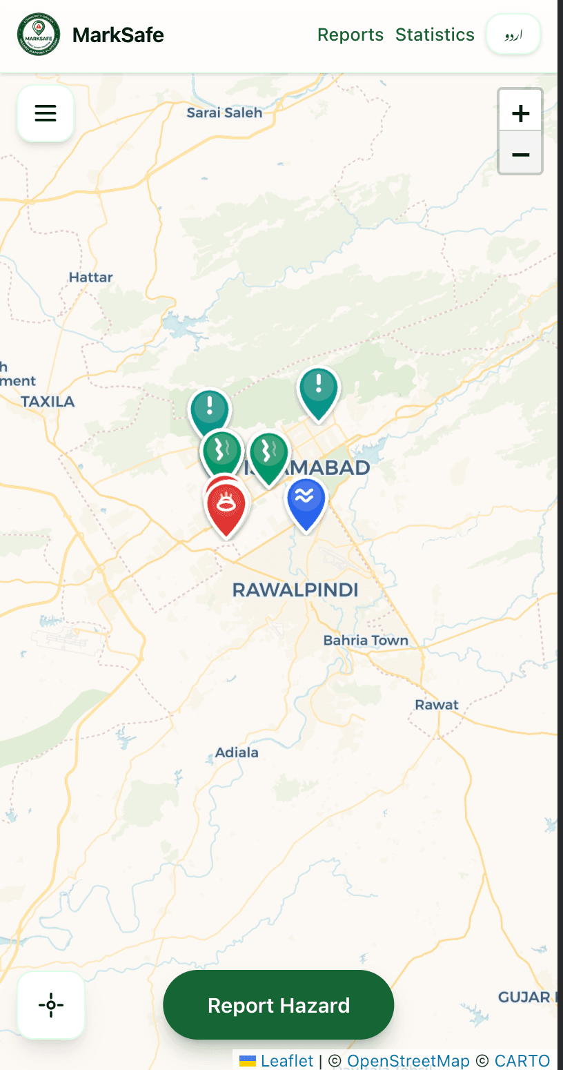
Homepage · Map view · Reports feed · Bilingual EN/UR
The mechanism is the product
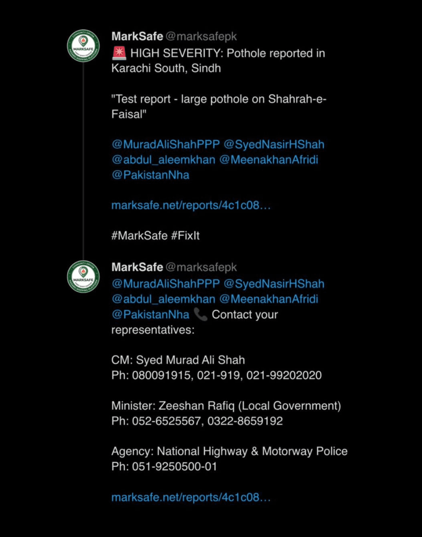
Most “report a problem” platforms die in a database. MarkSafe weaponizes X.
The political genius isn't the map. It's the auto-post. When a report gets community traction, @marksafepk automatically posts it to X · tagging the exact MNA, MPA, or minister responsible for that constituency. With evidence. Publicly. It turns a frustrated citizen's photo into an official's public accountability record.
01
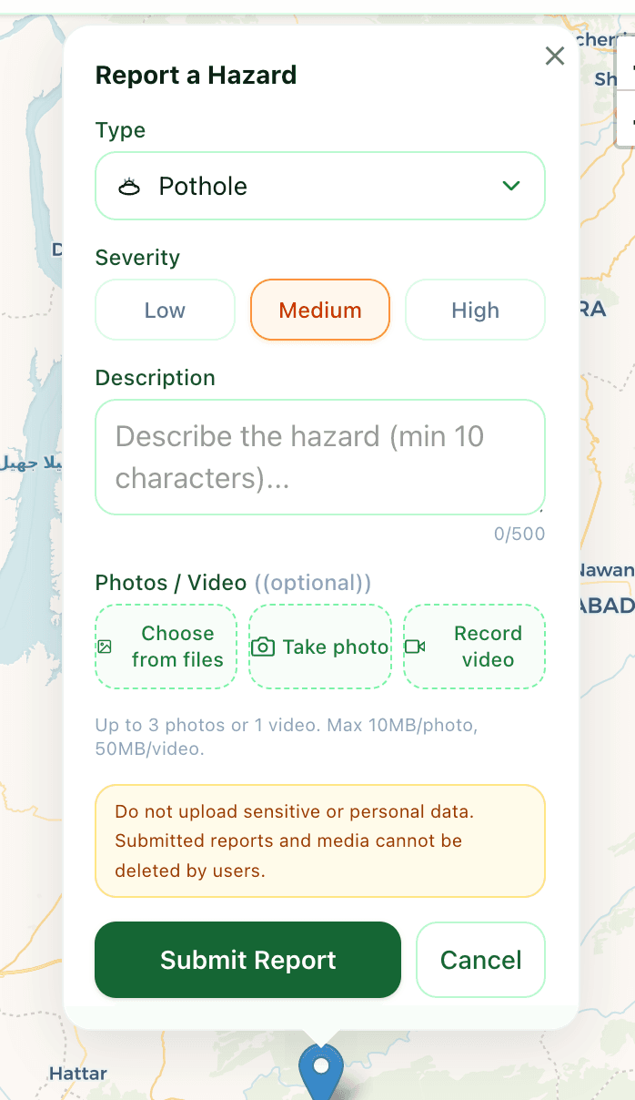
Citizen drops GPS pin
Photo or video evidence attached. No account required. ~30 seconds total.
02
Community upvotes promote it
Reports surface by urgency, not chronology. Collective verification, not lone complaint.
03
@marksafepk auto-posts to X
The constituency's MNA, MPA, or minister is tagged directly · with evidence attached. Public record, not a database entry.
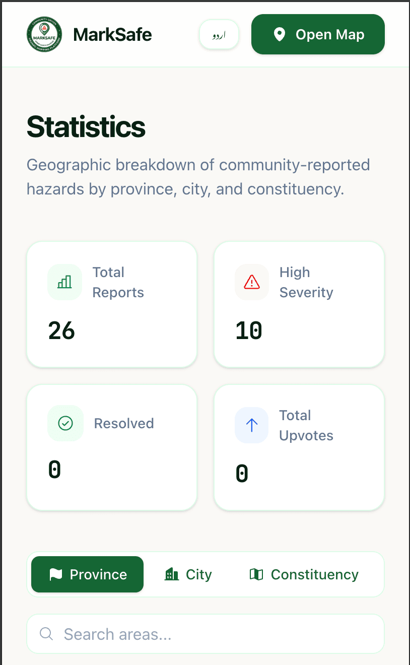
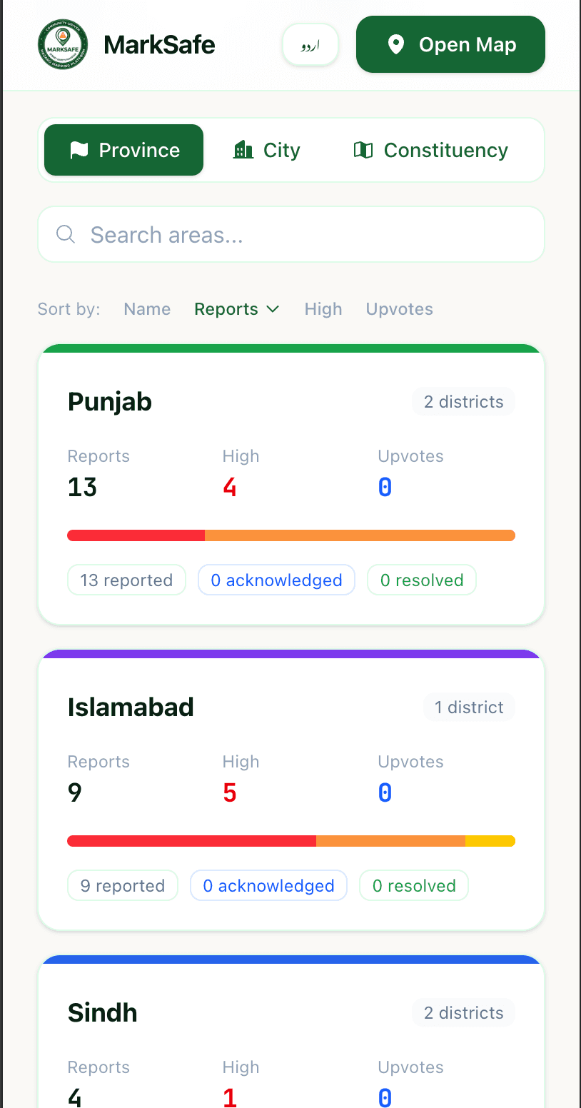
By the numbers
141
Districts covered
1,000+
Officials in database
8
Hazard categories
~30s
End-to-end report
36
URLs fully bilingual
Anonymous by design
“No accounts, no sign-ups,
no phone numbers.”
Anonymity here isn't a UX decision · it's a political stance. In Pakistan, reporting infrastructure failures to government bodies can carry real risk. MarkSafe collects zero personal data. No login flow, no phone number, no email.
A citizen in any of 141 districts can report a hazard in under 30 seconds, trigger a public accountability post to X tagging their elected official, and leave no trace. That's the safety feature.
Free forever. Built for the streets.
Bilingual-first
Every single page on MarkSafe exists in both English and Urdu · a full mirror at /ur/*. Not bolted on. Not a translation toggle as an afterthought.
36 URLs fully bilingual · including every blog post, the map, reports, statistics, and about pages. Urdu speakers are first-class users, not an afterthought.
URL structure
//ur
/map/ur/map
/reports/ur/reports
/statistics/ur/statistics
/blog/ur/blog
/about/ur/about
/blog/*/ur/blog/*
8 hazard categories
Potholes
Uncovered manholes
Exposed electric wires
Flooding
Broken roads
Unsafe construction
Broken streetlights
Open sewage
Karachi · Lahore · Islamabad · Rawalpindi · Peshawar · Quetta · Faisalabad · Multan · Hyderabad
What it proves
One developer. 141 districts. 1,000+ officials mapped to their constituencies.
This isn't a side project · it's public infrastructure. Built solo, end-to-end. OpenStreetMap integration, a hand-curated officials database spanning every elected constituency in Pakistan, bilingual content across 36 URLs, and an X automation layer that creates accountability where none existed.
Next
Four production AI products shipped end-to-end for one client · Emmy, Adsy, Dominic, Revvy.